Name of the site: Futur parking (solar located between the streets Amadoret, Montsec)
Municipality: Guissona
Region: Segarra
Chronology: 2nd century BC - 5th century AD
Promoter: Guissona Town Hall
Dates: 2014, 2015 and 2016
The area where the present archaeological intervention was carried out is located in the town of Guissona, located to the north of the region of La Segarra, in the centre of the plain of Guissona.
The site is located on an island formed by the Carrer Montsec (north), Camí de Morana (south), the Avinguda Notari Josep Faus (east) and Carrer Amadoret (to the west). It should be said that it is located in the middle of the ancient Roman city of Iesso, declared BCIN (Cultural Good of National Interest), in resolution of August 16, 1995.
The intervention allowed documenting the presence of stratigraphy of Roman chronology related to the ancient Roman city of Iesso in almost all the points of the plot.
The surveying work conducted in the first phase (June 2014) gave a positive result in all cases, although in some of the trenches the remains located offered a modern-day chronology (crop beams). It is also necessary to take into account the affectation to which this area was subjected as a result of the construction of several buildings in the north and west limits. At this point, the stratigraphy has been severely affected by the constructive works and the dumping of rubble and rubbish.
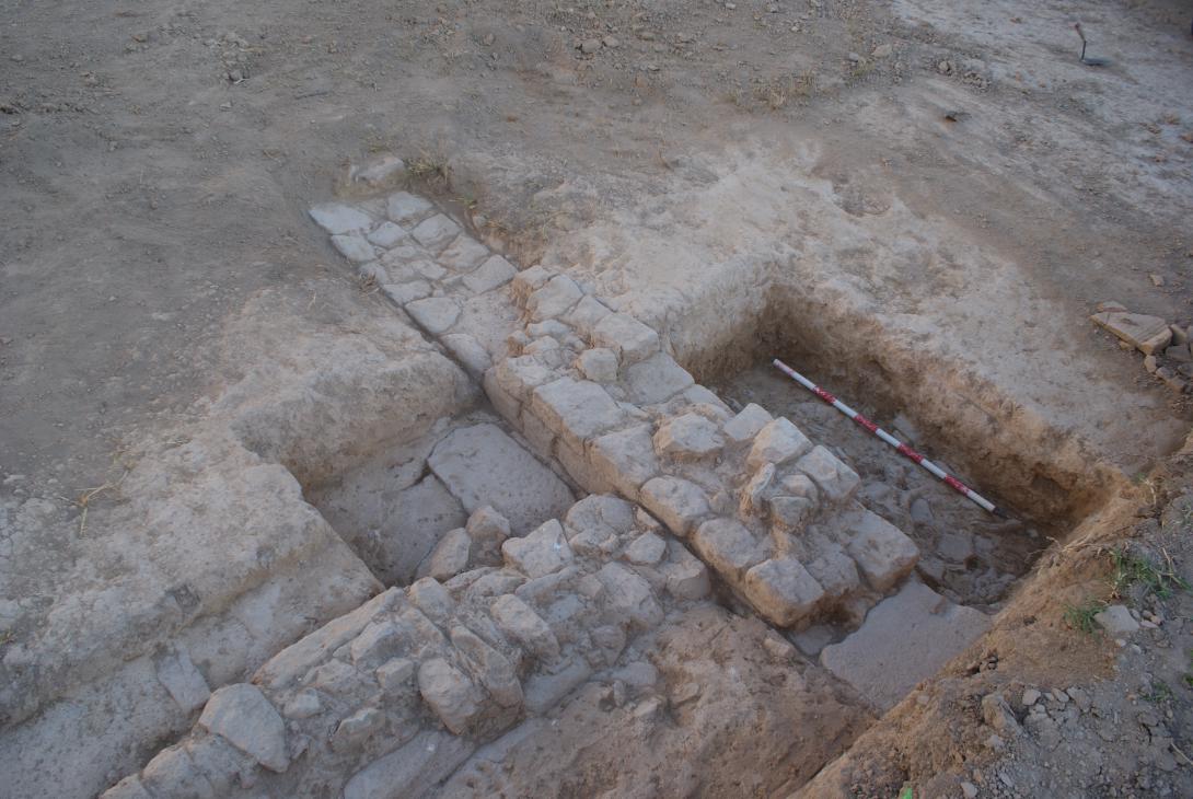
However, among the structures located we can remark a set of walls that would be part of the internal divisions of the houses of a Roman insulae.
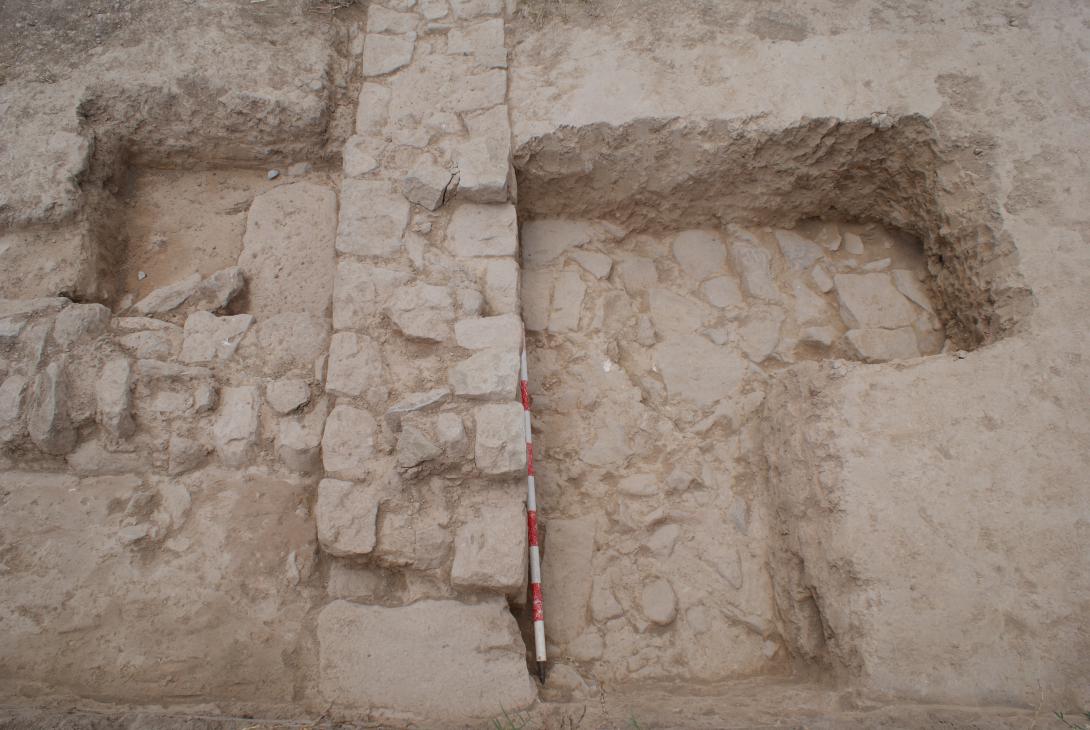
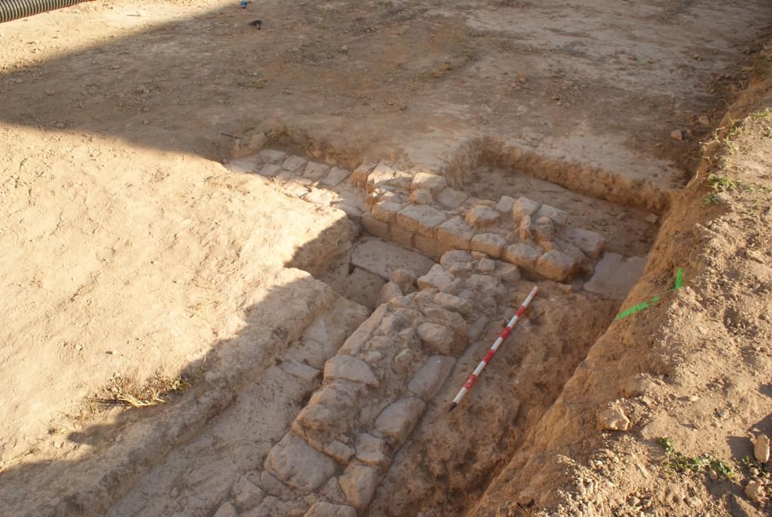
In sector 5 the documentation of a long wall, make us consider the possibility that we would be facing the south facade of decumanus minor. The calculation of the possible location of the north facade line coincided with the passage of trench 12, although a few centimetres further north. For this reason, it was decided to expand and unify the three open trenches at this point, obtaining very positive results. First, a second line of wall was found, coinciding with the possible location of the street façade line and, secondly, it was possible to document the good state of conservation of the remains and the extraordinary stratigraphic depth that the site presents. At the same time, all open trenches in sector 5 offered positive results, with documentation of Roman stratigraphy.
The trenches excavated on the upper terrace, at the eastern boundary, once again showed the interest of the site, with Roman stratigraphy on all of them and, as is the case with the trench 02, with structures associated with a high level of conservation.
To sum up, the intervention allowed obtaining excellent results, with the documentation of a large building from the 1st century BC to the 1st century AD. inserted into the urban grid of the Roman city and the documentation of the decumanus minor.
The detailed study of the documented materials allowed us to determine that we were facing several temporary stages of construction (context of city reforms). This same moment of reform would have probably affected the walls located during the first survey campaign at the top of the terrace, where the stucco levels of the walls of an area show several constructive phases for the building, whose origin could probably be located between the 1st c. BC and the 1st c. AD.
The works carried out during the second phase, however, allowed to study in depth the areas assigned to the possible decumanus, as well as the space that would occupy it, locating different levels of repaving inside its layout.
On the other hand, the results obtained on plot 2, show continuity in terms of stratigraphy and structures, with the documentation of the first levels of abandonment of the Roman period structures. These first levels of abandonment offer us a chronological framework towards the 2nd-4th centuries.
In the upper terrace of the plot 2 it has been possible to determine that the outcrop of structures or stratigraphy of Roman chronology (1st-3rd centuries AD) is located deeper than in the lower terrace, where the outcrop takes place at only 30-40 cm.
The ditch opened on the lower terrace for the construction of the new terracing wall during the last phase of the works (2016), which did not exceed 50-60 cm of potency, revealed a rich Roman stratigraphy, with a chronology between the 2nd and 4th centuries AD
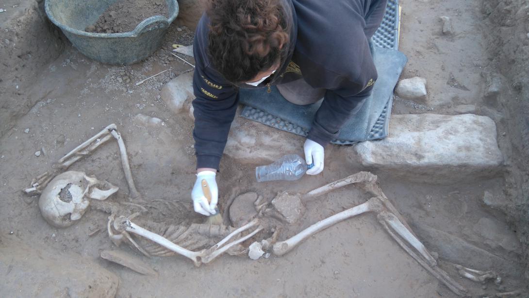
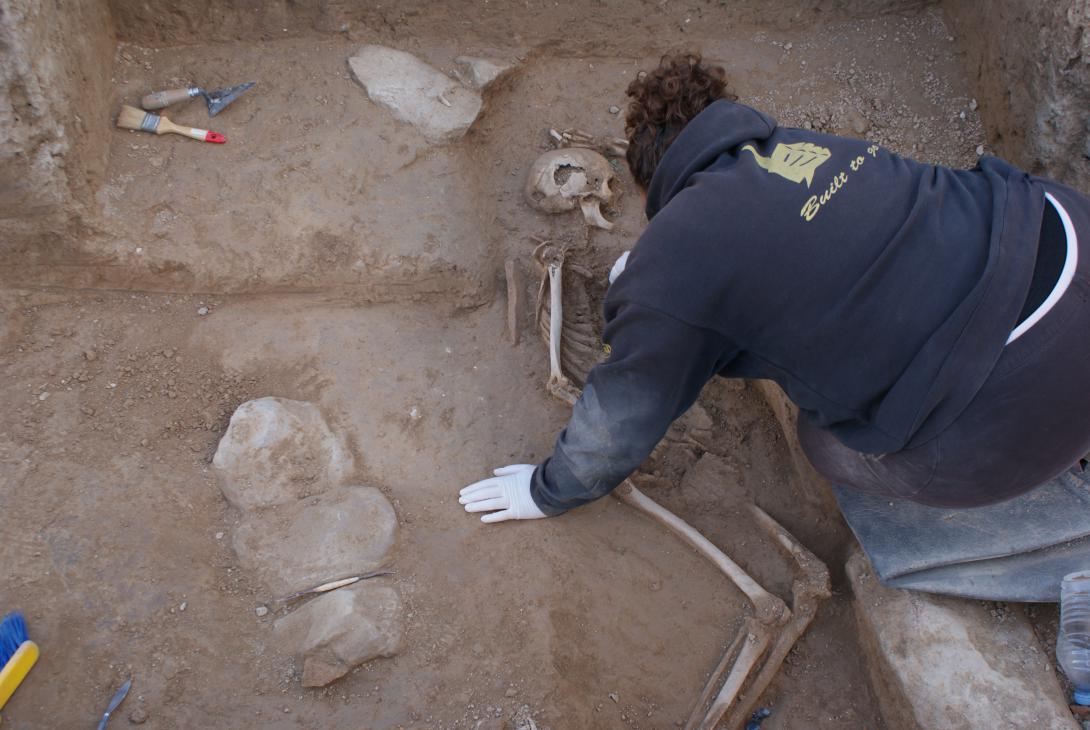
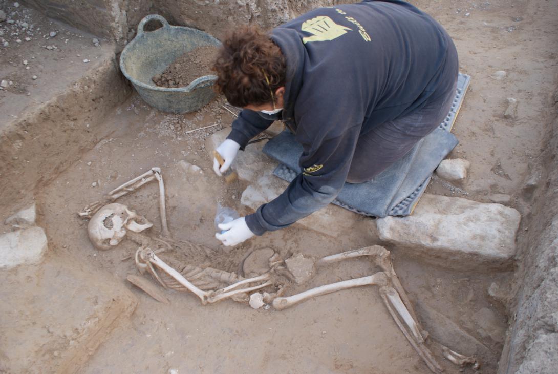
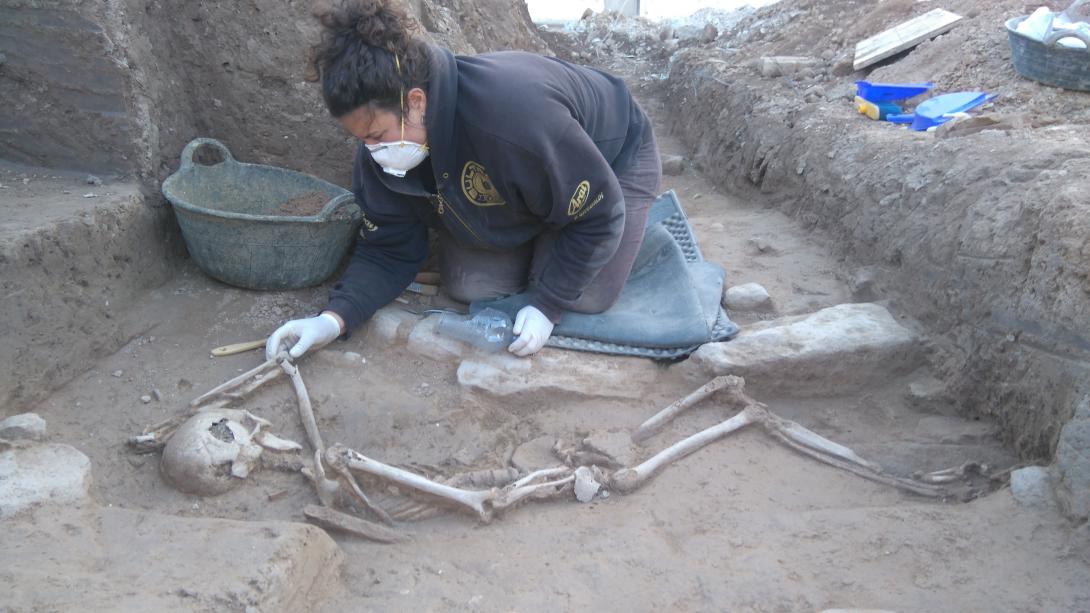
Among the structures located in the urban area of the ancient Iesso there are up to 3 walls, the remains of a possible channeling, various negatives and, especially, the documentation of a funerary set consisting of a possible burial covered with slabs. To its side, a body buried in a simple pit appeared. The presence of an incision caused by a cutting element in the back part of the skull seems to imply a violent death. The stratigraphic study and the C14 made in the remains of the UF 01, have allowed us to establish a dating in the beginning of the third century AD (most likely date, 217 AD).
The fact that the various negatives observed in the ditch of the lower terrace are filled with levels of ash and that the stratum documented on the surface shows clear marks of burning, seem to indicate a possible level of destruction during the third century, context in which could include the deceased and the various levels of documented demolition.